
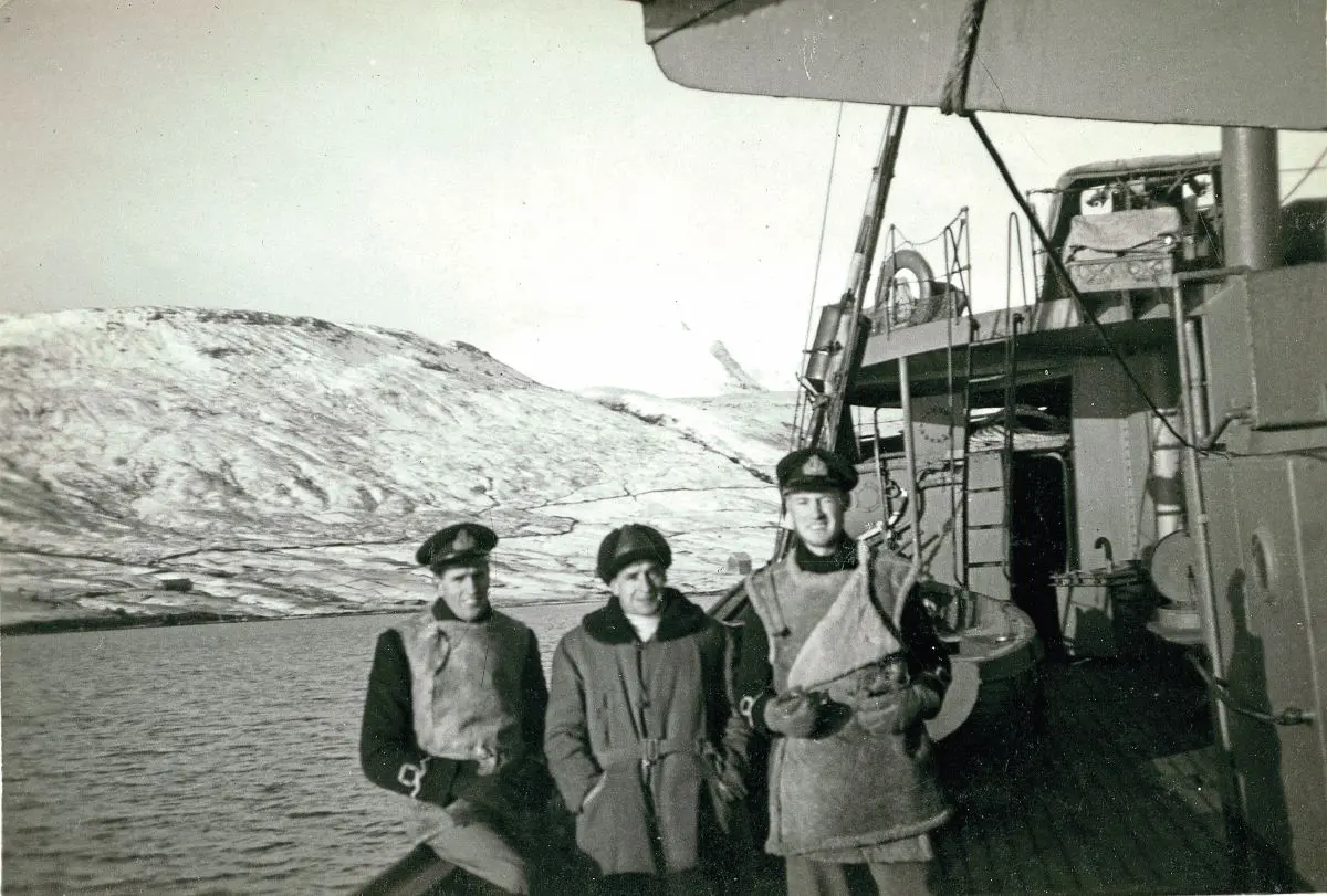
This year sees the 80th Anniversary of the end of World War Two. The well-known campaigns get much publicity, but less talked about is the battle of the Atlantic that raged for the entire duration of the war. Trying to keep Great Britain fed required a regular stream of ships crossing the Atlantic. The few stories Simon’s father told him of his time in command of convoy escort ships to try and protect the merchantmen against the relentless attacks from both submarines and the air, gave him a longheld desire to see where Everett Sr was stationed for the first half of the war, in Skalafjord, Faroe Islands.
WORDS & PHOTOGRAPHY: Simon Everett

Doing some research on Lt Cdr FA Everett’s wartime photographs led me to contact the Faroe National Museum which was very helpful and very interested in seeing the pictures and finding out what snippets of information I could provide from Dad’s recollections. It would have been easy to jump on a plane and fly but instead, I resolved to ride there and take the photographs, together with some other items, in person.
I started to draw up travel plans for late spring the following year. At the time the ferry from Harwich to Esbjerg was in operation and it was simply a matter of riding to Harwich, then up through Denmark to get the ferry to Torshavn. But the Esbjerg ferry was withdrawn for the following year, leaving me no alternative but a long ride in one day from the Hook of Holland, because of the available dates I could go and the limited ferry sailings to Faroe.
Enjoy more Motorcycle Sport & Leisure Magazine reading every month.
Click here to subscribe & save.
My new plan involved riding to Harwich for the overnight ferry to Holland, then riding through Holland, the northern corner of Germany and the full length of Denmark in one hit the following day. The dates I had available precluded me splitting the journey any further. I am fairly used to riding long distances in a day, often getting a feature to photograph at the other end of the country, so a 500-mile day plus work is not unusual for me. I had the tool for the job in the BMW R1150GS Adventure, thanks to our erstwhile editor Dave cajoling me into buying one whilst visiting a dealer for some classic motorbike shoots! I never regretted the purchase though as a mile-munching cart horse for carrying my photographic kit about it was excellent.
In preparation for the event I put new tyres on, Metzeler Tourance were the tyre of choice for me on that bike, they gripped fine and gave excellent mileage, I averaged more than 12,000 miles out of a set even lugging my kit about all the time. My camera gear fitted into the right-hand pannier, leaving the left-hand pannier for footwear, casual jacket and the file containing dad’s pictures. The remainder of my clothing and personal kit was in an SW Motech bag across the seat and panniers. On the tank was my trusty Oxford Lifetime magnetic tank bag I have had since 1979 so it has certainly lived up to it’s billing, where I carried a 750ml flask, mug, and bag of fruit flapjack cut into bite size pieces, so I could graze on the go and maintain progress without having to stop to eat. I would eat well on the ferry to set me up for the long ride ahead of me, only stopping for fuel, where I would also have a drink and answer calls of nature.
The ferry was comfortable and the food was decent. I had a hearty breakfast to ensure I was set up for the day, but as I rode off the ferry I was met with a howling gale and torrential rain, conditions that were to last all day. It was horrendous, with standing water in the tramlines the trucks had left and heavy spray, visibility was drastically reduced, and I had to adjust my expectations accordingly.
Heading for Utrecht and Appledorn, and with about 900 miles ahead of me, I resorted to using the motorway. Things were tolerable whilst going through Holland but as soon as I got near the German border, with Bremen as my target, it very quickly became obvious the two-lane autobahn in these conditions was a death trap. At one point I was coming up behind a lorry on a very straight section with no headlamps in sight behind me, by the time I was alongside the lorry, maybe 10 seconds later, engulfed in spray, headlamps were feet from my tail. The speed at which that car had come up on me was just incredible, I dread to think how fast it was going. I got past the lorry and pulled back in and decided to come off at the very next opportunity. I needed fuel anyway. At the bottom of the ramp was a roundabout with a fuel station on it that had a café attached.
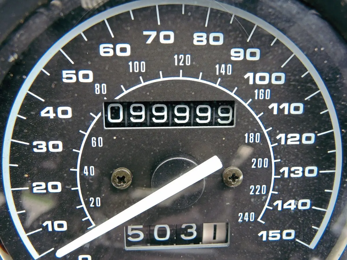
Fuelled to the brim and coffee in hand, I looked at the road atlas for an alternative route and to give me an idea of where to head for, town by town, the satnav would take care of the detail. I set it to avoid motorways and set off again. To start with my alternative road ran parallel, just one field distant from the motorway. After about five miles there was an enormous tailback, I clocked it at about eight miles long and it culminated in masses of emergency flashing lights dealing with a huge pileup. On my road I had hardly seen a soul and I was still covering the ground just about as fast as if I had been on the raised autobahn, but being lower and with trees it was far more sheltered from the horrendous conditions. I followed what we would call an A road to Hamburg, there I then had to get across the Elbe. My route took me over a very elevated bridge with Perspex side screens to try and break up the wind. Even so I was so buffeted I actually thought I had a flat tyre on the front and stopped to plug it. There was nothing wrong with my tyre, it was just the powerful cross wind and eddies pulling me about. As soon as I started to get down the other side things returned to normal. As I was leaving Hamburg my speedo approached the 100,000 mile mark, so I pulled over to get a picture with all the 9s, these things need recording for posterity.
Turning north after Hamburg the countryside changed and became very gently rolling but mostly flat. The roads were simple, well surfaced and with very light traffic, but I had to get a wriggle on if I was going to get to my hostel in Aarhus before they closed, so I took the main trunk road heading north through Denmark. I arrived in Aarhus, checked in and went to buy something substantial from a local supermarket to eat in the hostel garden with a couple of beers then crashed into my bunk ready for another early start in the morning. I still had another 100 miles to get to the ferry first thing.
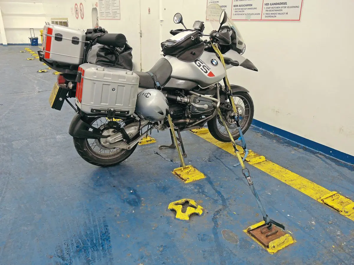
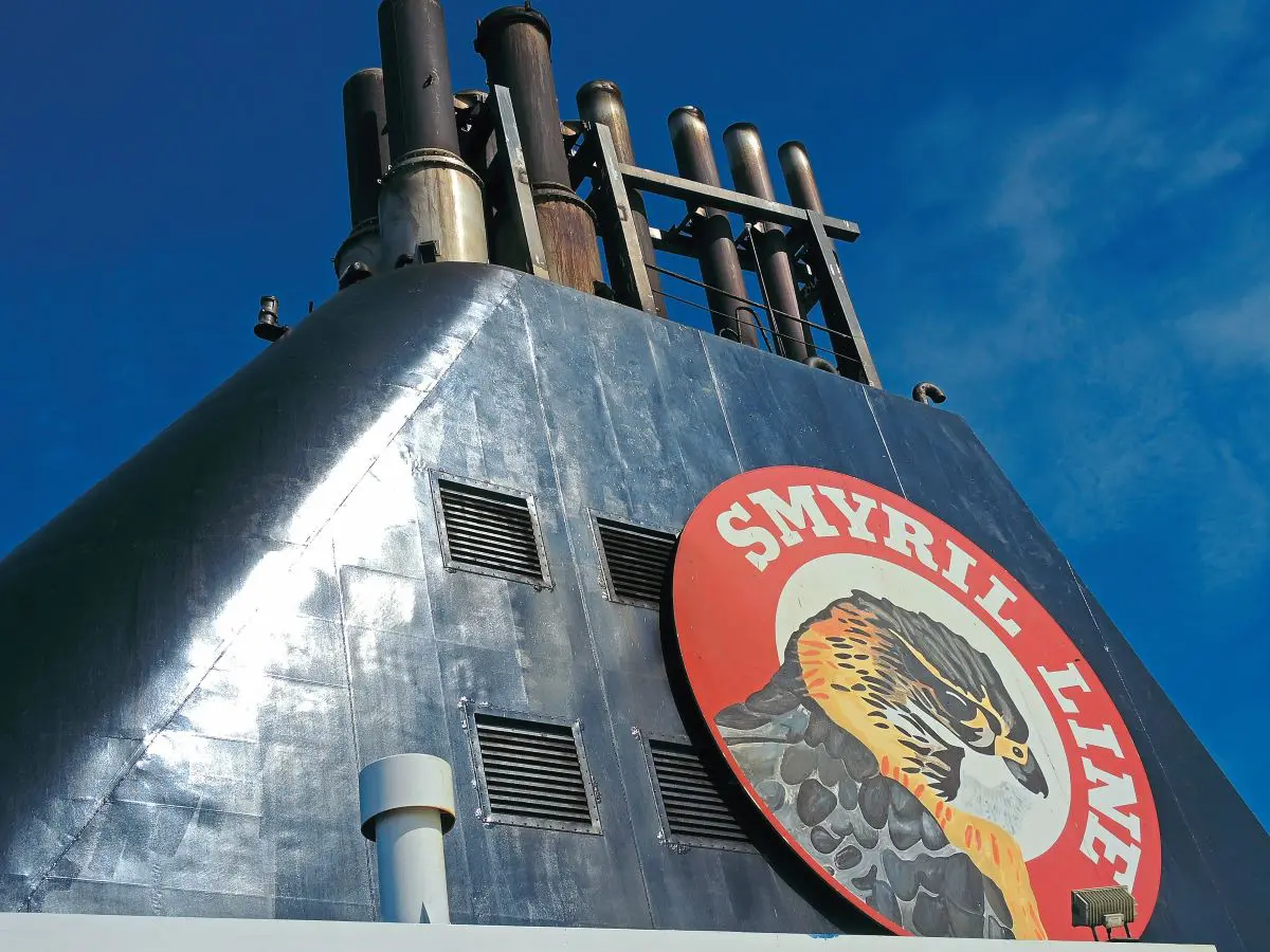
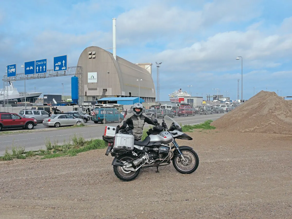
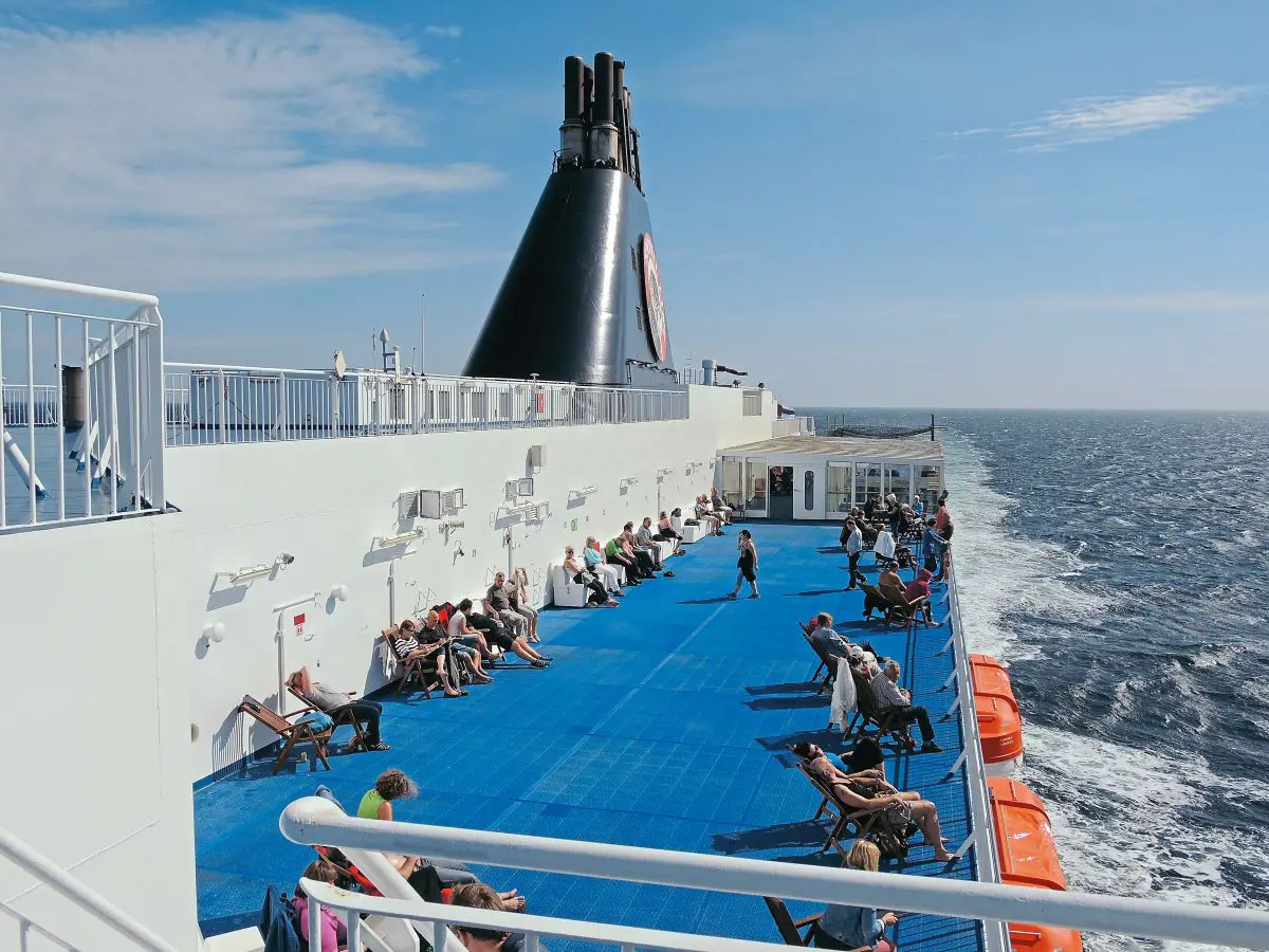
After an early start and easy ride to the ferry I joined the queue on the bare earth gathering area. It was bleak, open, cold and blowy. Thankfully I didn’t have to wait long before I was ushered into the warmth of the ship. I was supplied with straps but left to secure my own bike for the trip. I made certain it was secured at every angle – even if the ship had capsized my bike would have remained strapped to the steelwork. I had been warned about the possibility of rough seas and had no intention of coming back to my bike on her side. I made my way up to my cabin and then to the viewing deck. The route follows the Norwegian coast before crossing close to Muckle Flugga at the northern end of Shetland – that was the last land we saw for the next 24 hours, the crossing is 36 hours in total. I was really glad of the rest after my long ride the day before, to be able to
relax with a FOROYA BJOR and then soak my aches away in a hot shower was just bliss.
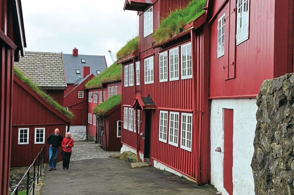
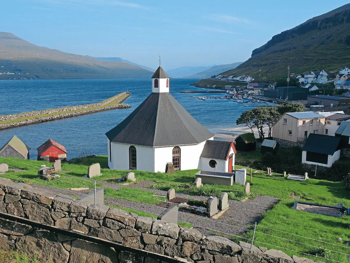
The first view of Torshavn is quite special with the dark red buildings contrasting white eaves nestled around the harbour. Turf rooves are commonplace – this is a very traditional place living very much the same for the last 50 years, save for the internet. However, riding off the ferry to find the Hotel Foroyar I soon discovered there is no satnav coverage on the islands. I had loaded maps specially for the trip, but whilst the islands were shown, there was no road mapping. It might have changed now, of course. I had to resort to the time-honoured method of map and route notes.
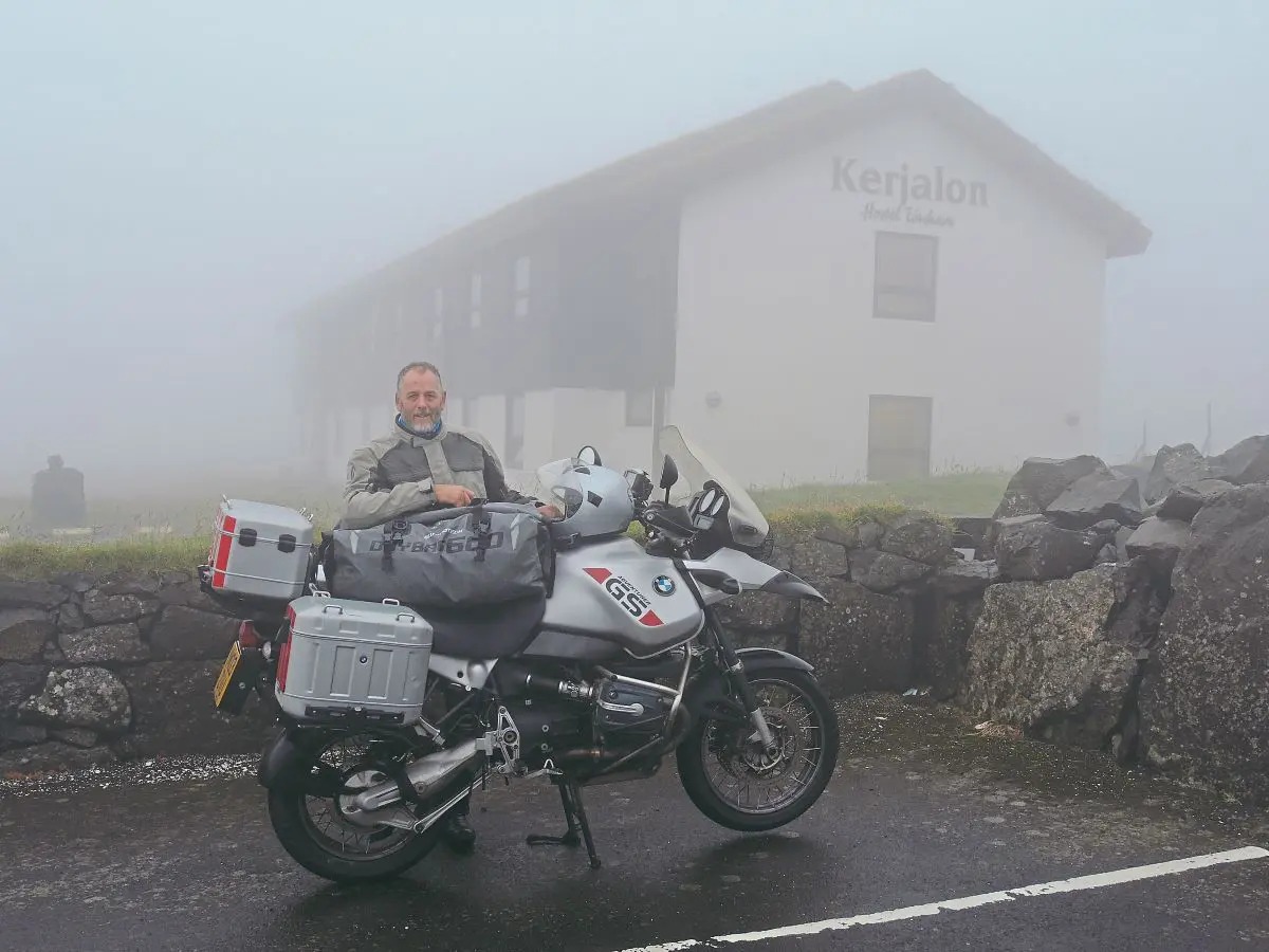
Heading out of Torshavn and up the hill to the turf-roofed hotel, the hill was shrouded in thick cloud, visibility dropped to about 30 yards, making navigation very difficult. I missed the turning because of not being able to see both sides of the road, and dropped
downhill again. After asking for directions I got to the hostel and unloaded amid the thick fog.
The following day my first priority, after a lovely Scandinavian breakfast, was to ride with my cargo of dad’s wartime pictures to the Faroes War Museum based in the Sector Operations Room, built in 1942 at Sorvagur on Vagar island. This site is from where the battle for the North Atlantic was controlled and also served as an early warning station. Churchill was very astute – within 48 hours of the Germans invading Denmark the Pioneer Corps were establishing an agreed protection presence on the islands to safeguard the northern route to keep Britain supplied.
There are few roads on the islands, so navigating with the tourist map was perfectly acceptable. I put the envelope with the precious photographs in my tank bag and headed off. Leaving the hotel I had to head up over the mountain Faroe is very hilly, much like the wilder parts of Scotland but with fewer dwellings and a much sparser population. To get to Vagar from the island of Stremoy required riding through the Vagartunnelin, a 5km long undersea tunnel that comes out on the opposite side of the fjord and follows the coast until it suddenly swings inland over the mountain at a sweeping hairpin. These sudden changes in direction are a feature of the roads on Faroe and are due to the topography and geology of the islands. I followed route 11 over the mountain and through the village of Sandavagur and Midvagur before following the shoreline of the Leitisvatn (or “lake above the ocean”), which empties via an impressive waterfall over the cliffs.
The war museum is situated very close to the island’s airport, a lasting legacy of the British protectionist occupation. The Royal Engineers built it by flattening part of a mountain and building up ground to create one, flat runway. It remains the only airfield on the entire archipelago. I spent the entire day at the museum learning more about the wartime situation and, in particular, about dad’s involvement and exploring parts of Vagar.
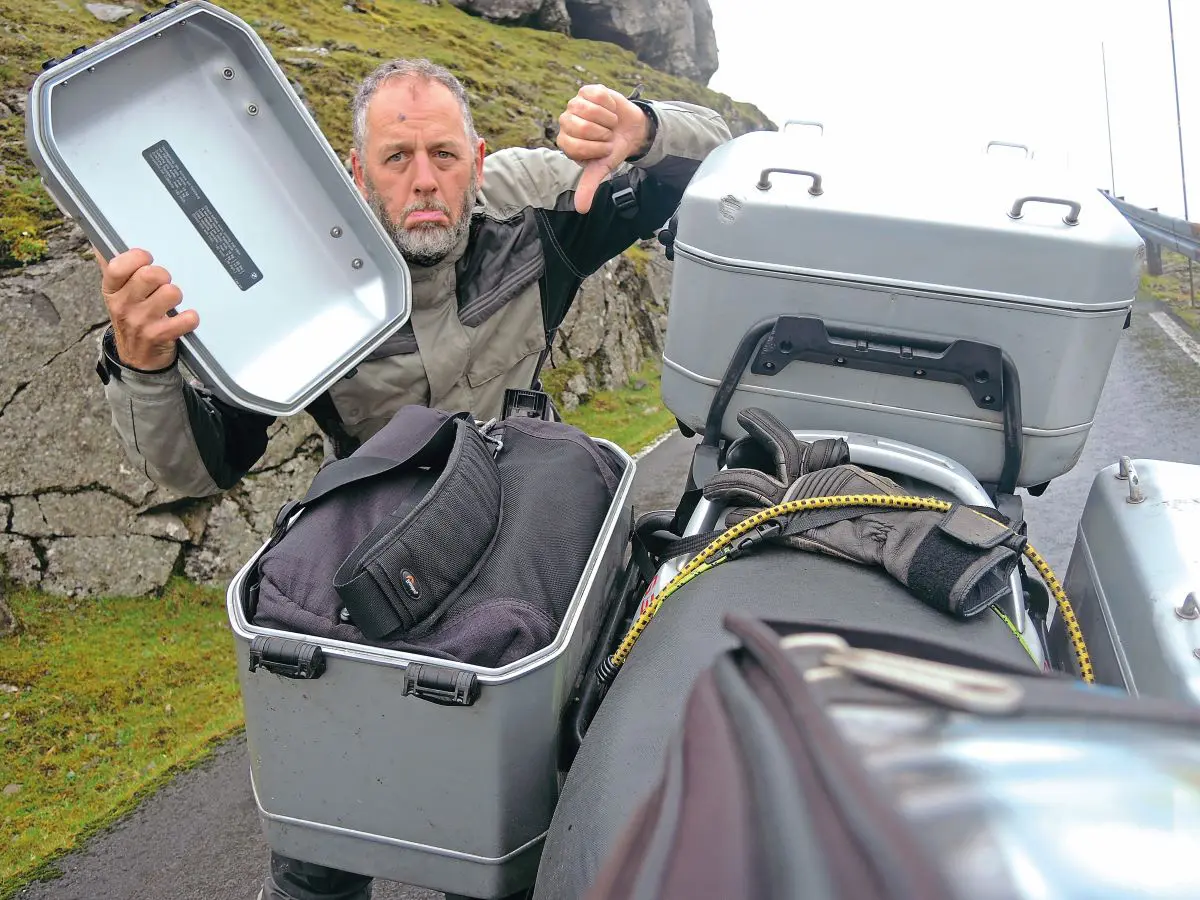
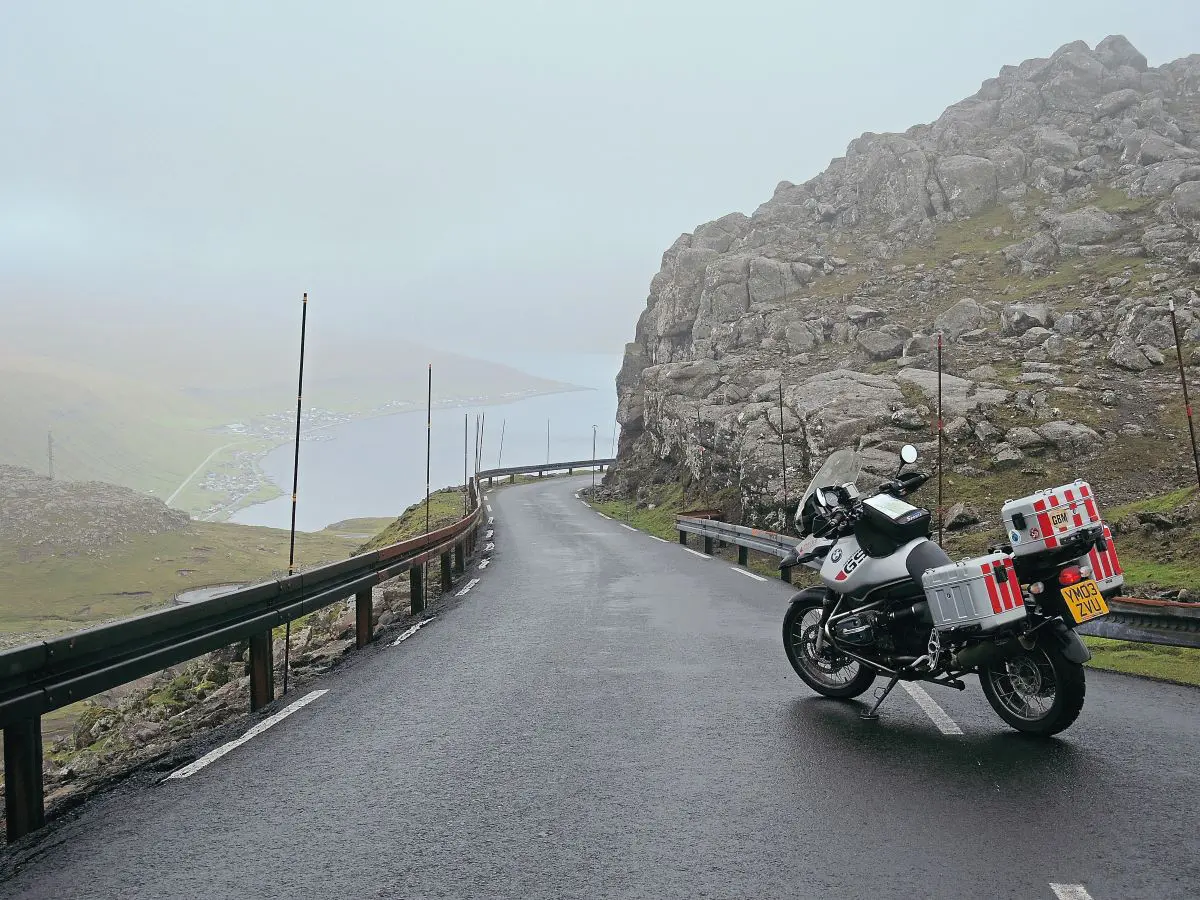
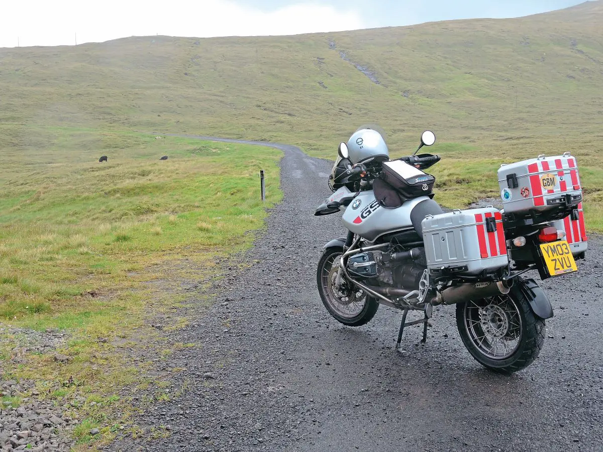
Unfortunately, the weather had only marginally improved, but at least the fog was gone. The road surfaces were superb, everywhere that was tarmacked that is. There are quite a few gravel roads in the more remote areas, but they are well graded and in very good condition. What nothing can prepare you for is the incredible strength of the wind – I was glad I was on a big, heavy bike because it helped to keep me on the road. More than once a sudden gust took me right across the road and I heard that during my stay there were three motorbike tourists blown completely off the road – one had a very serious tumble down a mountainside as a result of a strong gust. At one point I went to get my camera out of the metal pannier and the wind blew the lid out of my hand and broke it off its hinges, sending it whirling down the hillside like a piece of discarded litter. I
scrambled down and retrieved the lid from where it lodged and thankfully, I had some spare bungy straps with me so was able to secure it for the rest of the journey. It wasn’t very elegant but it sufficed and I was able to get new hinges when I got home.
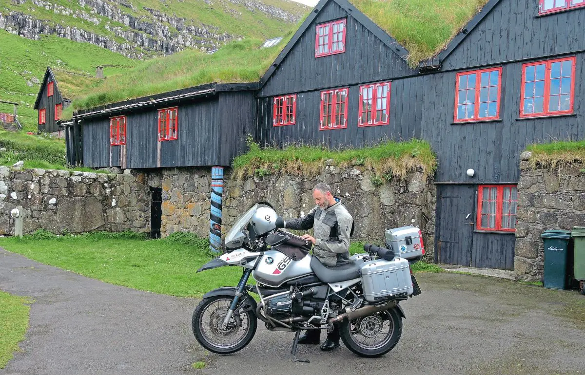
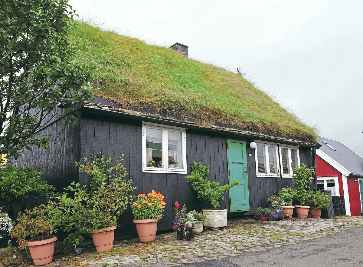
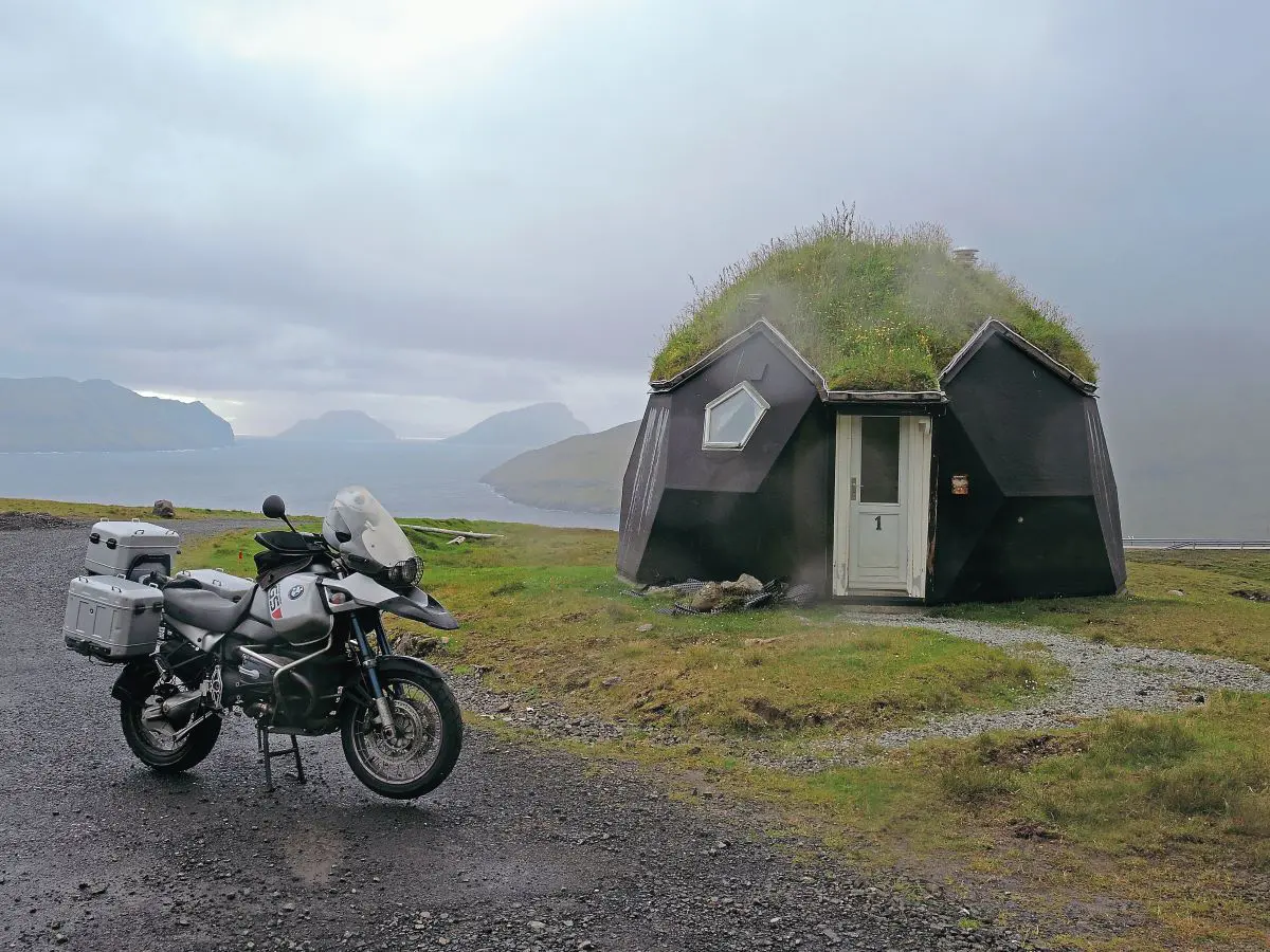
One of the features of the Faroes is the very ecological and sympathetic building, many of the buildings have a turf roof which is both insulating and makes the building blend into the landscape. They have to mow the lawn in the sky too! One visit I wanted to make was to Kirkjabour, the southernmost village on Stremoy and the oldest historical site of St. Olav’s Church and the ruins of Magnus cathedral beside the oldest wooden house still inhabited in the world, Kirkjabourgarour, it all dates back to 1200.
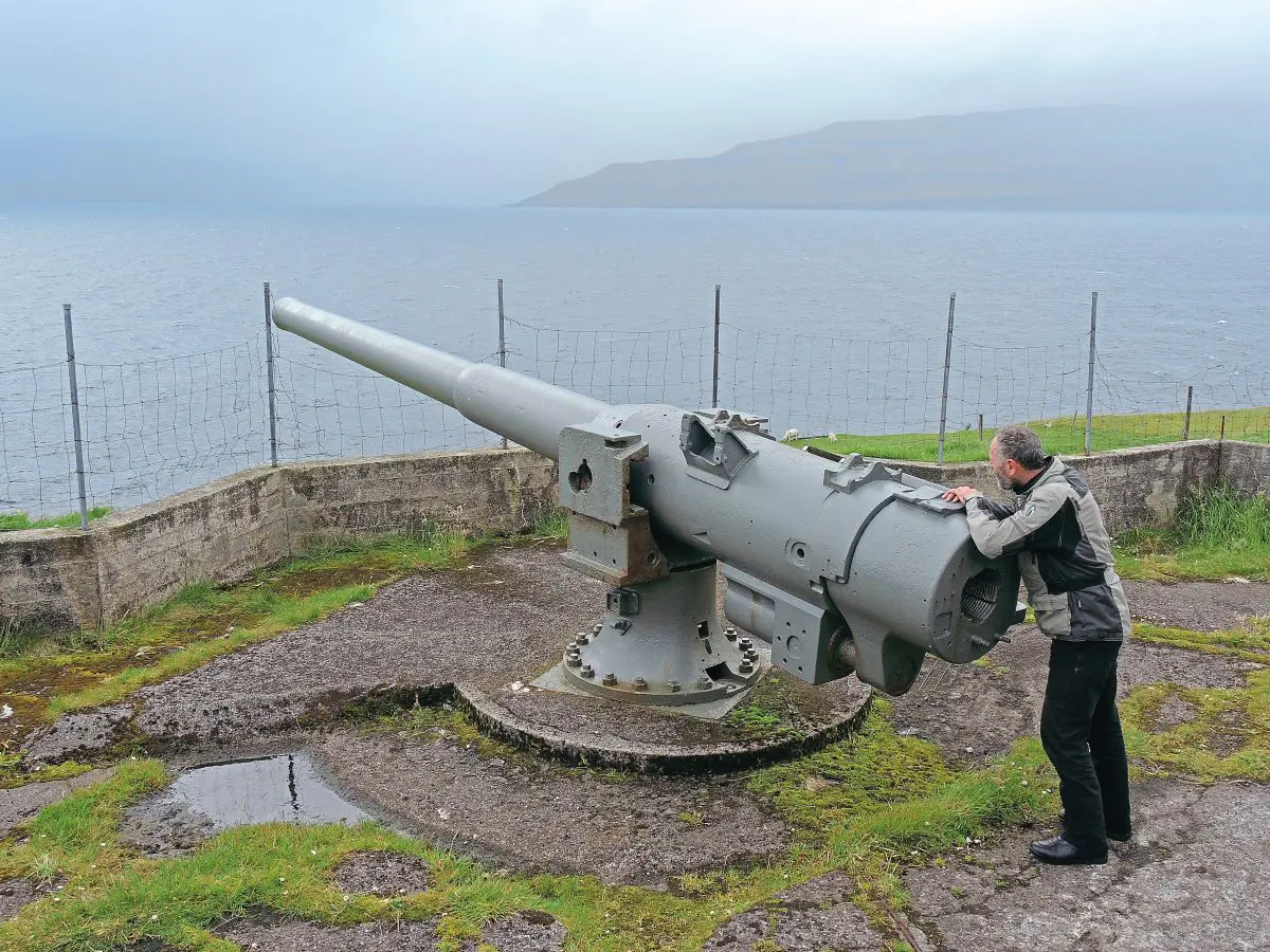
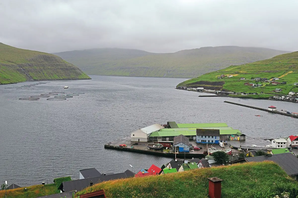
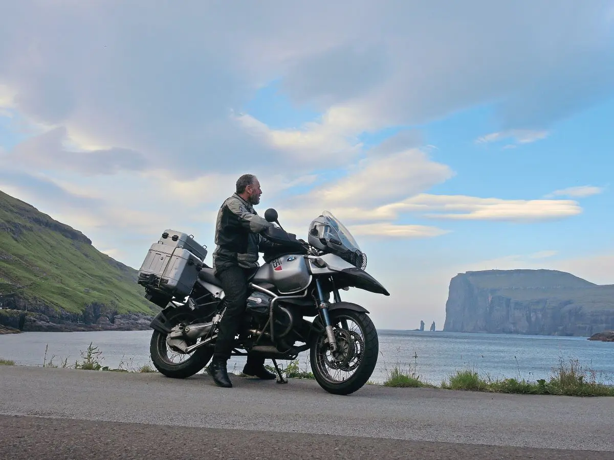
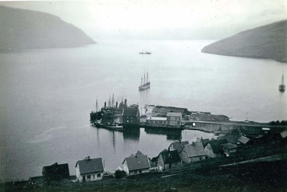
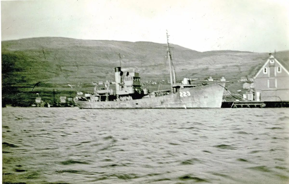
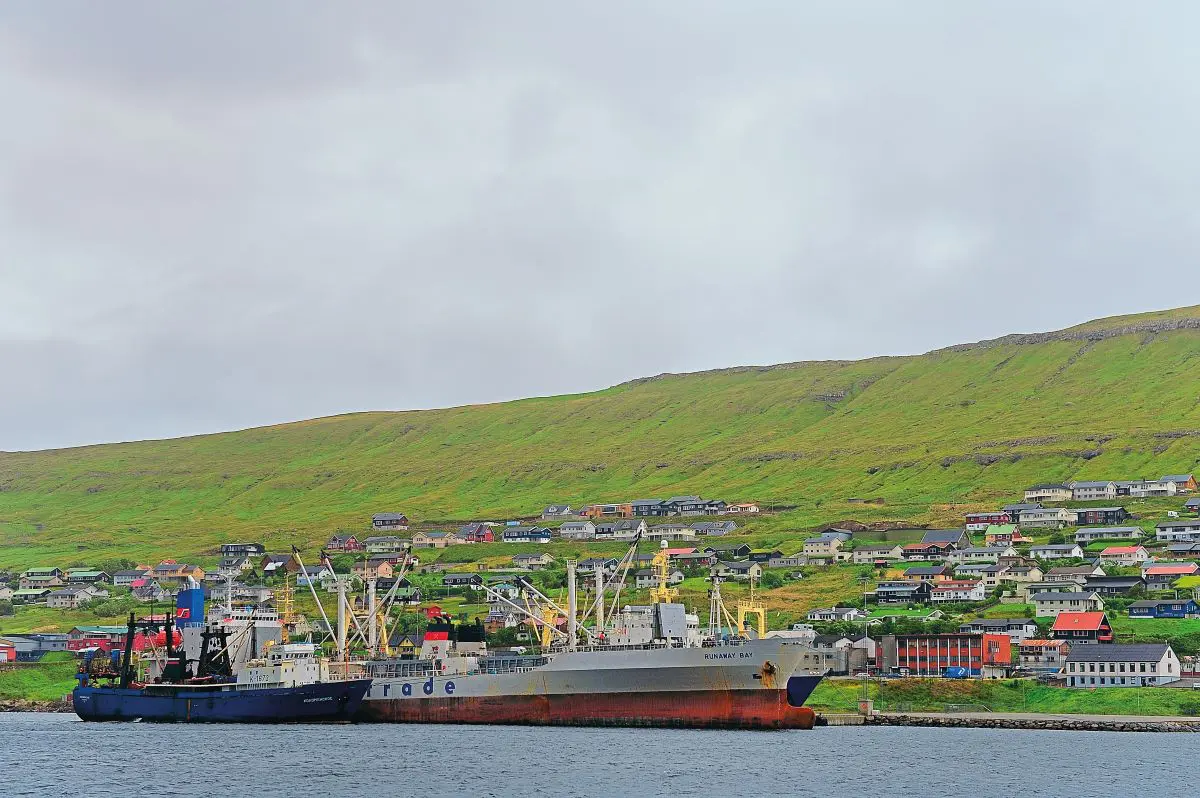
The landscape and scenery everywhere is spectacular when you get a clear day. Some of the higher roads are lined by snow stakes, although Faroe gets very little frost due to the islands’ position in the Gulf Stream, much like the west coast of Scotland. Fog was very prevalent when I was on Faroe, but it is patchy you can go to the next fjord and it can be clear. This happened to me on my next visit to Skalafjord which is where I had pictures of Dad and the ship alongside. This was the main naval base in Faroe and where there were massive fuel tanks which are still there and still in use as fuel tanks for the islands. The entrance to Skalafjord was protected by several huge guns with strategic placements, one of which is just outside the town of Runavik at the village of Nes. I had to go and see it on my trip to the harbour, such was the strategic nature of the islands, they were under constant attack from sea and air.
Having found the gun I worked my way back to the harbour and found the harbour master. Everyone was extremely friendly and when I showed him the pictures and what I wanted, he immediately offered to take me out in the launch to get a photograph looking back at the quay with a ship alongside, almost the same as the one Dad took of Leicester City alongside, and he wouldn’t take any kind of payment either. The Faroese are very pro-British, because of what we did for them during the war.
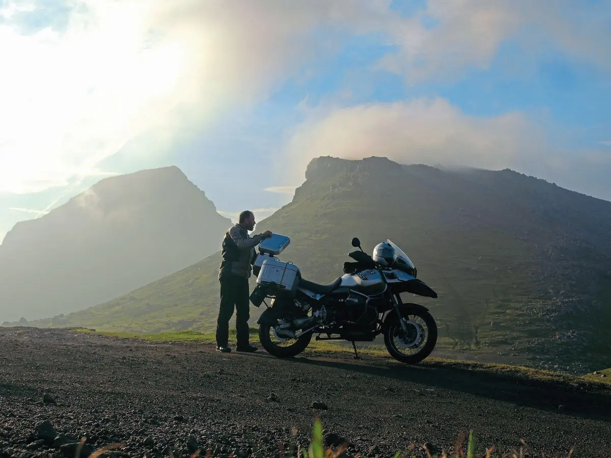
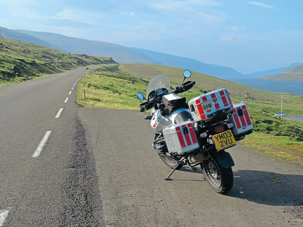
The roads are in superb condition, but then there isn’t a huge amount of traffic using them and there aren’t that many habitations to provide a link to, but in true Scandinavian style everything is done well. To cross the strait separating Stremoy from Esturoy meant crossing a tall, sweeping bridge that reminded me of the bridge to Skye. Long, sweeping curves with visibility for miles makes riding easy, but remember to be mindful of that wind. Fuel is another consideration as fuel stations are fairly rare, so keep your tank topped up and an eye on your mileage. I was on the R1150GS Adventure, and even on these roads, had a comfortable 250 miles range so I was never worried.
My next excursion was to Vestmanna in the north of Stremoy, it meant retracing my steps towards the tunnel to Vagar but branching off along the coast road along the south-western side of the island, where the road follows the contours, swooping around the mountains and bays giving constant changes of view. From Torshavn it is about 35 miles but that takes about an hour on these roads.
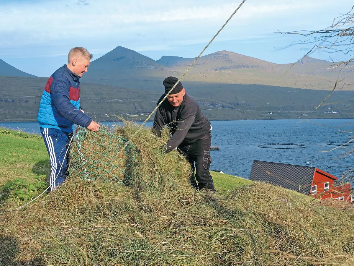
The town of Vestmanna has become enlarged over time, but the layout is essentially the same and the viewpoint in Dad’s picture was easy enough to locate. The harbour hasn’t changed at all, the quay is still the same, like life on Faroe, it doesn’t seem to have advanced much from the 1950s. For instance, they still make hay by hand, draping the scythed grass over lines of fencing to dry in the wind. There is no mechanised agriculture here, it seems to be a very natural way of life with simple tastes. With such mountainous terrain, sheep are the main form of meat and with the mutton hung to dry in sheds, you can smell the drying sheds in every village. Fishing is the most important aspect of their lives, along with fish farming, much like Scotland.
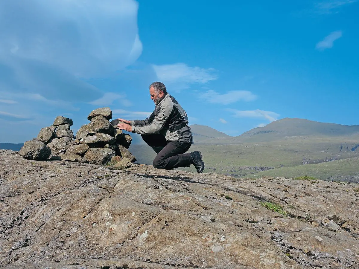
I took time out to explore more of the islands, just finding spots on the map and riding to them, unfortunately the weather wasn’t the best, but when the sun shines the scenery is spectacular. All too soon it was time to catch the return ferry and ride home ready for work, a week was as much time as I could get, so it was another focussed, long ride home. I am glad I did it though, I discovered more about my dad and his exploits during the years of conflict. If you want a destination that isn’t full of tourist buses, cyclists and Grand Tourers, the Faroe Islands are one of the few still left undisturbed and largely undiscovered. Just go.